Processing Your Payment
Please do not leave this page until complete. This can take a few moments.
- News
-
Editions
View Digital Editions
Biweekly Issues
- Nov. 17, 2025
- November 03, 2025
- October 20, 2025
- October 6, 2025
- September 22, 2025
- September 8, 2025
- + More
Special Editions
- Lists
- Viewpoints
-
Our Events
Event Info
Award Honorees
- Calendar
- Biz Marketplace
Staying afloat | Funding cuts at GoMOOS have made for rough waters, but CEO Philip Bogden still has high hopes for the ocean observing system
Like those varied credit cards, GoMOOS is one of dozens of monitoring systems spread out along the U.S. coastline, from Maine to Louisiana to California. But since GoMOOS was founded in 2000 as a working prototype of a larger national ocean monitoring system, it's worked to champion a collaborative environment among ocean observing systems that would share the huge amounts of data flowing from each group. It's the development of that common language ˆ like the Visa transaction network that links different banks and merchants ˆ that's essential to the success of a widespread national ocean observing system, says Bogden.
As part of that system, GoMOOS maintains 10 buoys in the Gulf of Maine, each swaddled with high-tech oceanographic monitoring equipment. Every hour, each buoy conveys data via satellite telemetry or cellular signal to GoMOOS, which filters the information and uploads it to databases at oceanographic organizations around the country, from the National Oceanographic and Atmospheric Association to the National Data Buoy Center. Meanwhile, data from those organizations ˆ and many others from California and the Gulf of Mexico to the Gulf of Maine ˆ speed to other sites such as the Integrated Ocean Observing System.
But Bogden's hope that a collaborative web of ocean observing systems will one day become the underwater version of the National Weather Service may be in serious jeopardy. GoMOOS this year saw its federal funding fall to just $500,000 from nearly $2 million in 2005. And since the nonprofit organization relies on the federal government for the bulk of its $3 million - $5 million operating budget, Bogden says GoMOOS will be running lean this year.
Mainebiz recently sat down with Bogden in his office at the Gulf of Maine Research Institute on Portland's waterfront to discuss how GoMOOS plans to make it through 2006 on a shoestring budget, and why collaboration is the key to building a national oceanographic monitoring system. The following is an edited transcript.
Mainebiz: As a regional system, who's behind GoMOOS?
Philip Bogden: We have over 40 members now. Our membership represents the broad array of end users from the scientific research community to Maine and Massachusetts lobstermen associations to harbor pilots. We also have members from state government, and now we're getting federal government members.
What was the genesis of the program?
The earliest roots for this thing was a NOAA program in Penobscot Bay that [was launched] to understand the oceanography as it related to the ecosystem there. Some of the key players were the Island Institute, Bigelow Laboratory for Ocean Sciences and the Maine State Planning Office. And then quickly it grew to include a number of other key players in the state and became a regional enterprise.
The University of Maine was involved at that point. The chief scientist, Neal Pettigrew [an associate professor in UMaine's School of Marine Sciences] was responsible for the Penobscot Bay buoy program, and GoMOOS really grew out of that. What they realized at the time is that you couldn't realize the issues in Penobscot Bay unless you had a broader understanding of what was going on in the greater Gulf of Maine, [which stretches from Cape Cod to Nova Scotia].
What were goals for the broader monitoring system?
The ocean has largely been this black box, and we really haven't been measuring it adequately for long enough to understand [certain] phenomena in great enough detail to predict them. There's the decimation of groundfish populations, there's lots of distributions in the booming lobster industry ˆ these things are all related in some way to ocean phenomena.
You hear the lobstermen talking about lobsters being late coming to shore one year or being particularly strong, but nobody really understands why. There are probably as many theories as to why the lobster industry is doing what it's doing as there are lobstermen. But there's been a real dearth of actual observations of what's going on. And now, the GoMOOS array is being used by lobstermen to try and get a sense for what's going on.
Originally, the buoy array was used for surface conditions ˆ wave height, air temperature, things like that. Now there are subsurface salinity and temperature measurements throughout the water column. There are acoustic devices for measuring currents and there are optical measurements from which you can infer things about plankton and plant life in the ocean. Lobstermen have been using the bottom-temperature measurements, and they've been able to correlate [those measurements] with shedding in the lobster population.
If this project is useful to people like lobstermen and fishermen, it seems that it wouldn't have much problem getting the funding it needs.
A big problem in this country, quite frankly, is that there's not a huge appreciation for science. The funding for science is going down and there are lots of practical applications that aren't getting funded. So the new business model for ocean sciences and ocean applications is one where you're no longer trying to do single-purpose stuff. The greater your benefit for a fixed cost, the more easily you're justified for practical funding.
There are lots of little entities out there doing their own little projects, but the idea is to bring them together into a whole that's greater than the sum of the parts. That's a little trite, but that's the objective. If you can create real-time data flows then all of a sudden you can serve multiple purposes in addition to the original purpose for which you got the data.
Is it a tough proposition to merge those pieces of data when they're coming from all different sources?
What we're doing is taking the technologies of e-commerce, which allow computers to talk to each other and share information. This is an environmental analogue of Visa. It's really just an agreement between partners about how they're going to share information. We rely heavily on Open Geospatial Consortium standards, a consortium of private sector, government and academic institutions that are getting together and developing the specifications for environmental data exchange.
What technology hurdles have you had to jump at GoMOOS to work with data from other ocean observing systems?
It's not a technical problem anymore. But this would have been a pipe dream 10 years ago, because these technologies didn't exist. These days, it's more of a cultural problem. So GoMOOS is there to bring the people together, and bring together the potential providers of information, whether it's Woods Hole Oceanographic Institute or NOAA or UMaine.
So why did funding become a challenge this year?
In general, federal funding for anything except for Department of Defense and Department of Homeland Security is getting cut. Funding for science, whether it's applied science and practical science like at NOAA or research and development at the National Science Foundation, these federal programs are getting their budgets cut.
How has that affected GoMOOS?
We've been operating in the $3 - $4 million range, and we've leveraged federal dollars with a lot of other resources. The cut [in federal funding this year] from $2 million to half-a-million dollars was huge. There's a part of the budget that is very hard to find funding for, [which is to support] the kind of base infrastructure, like maintaining and deploying the buoys. It's relatively easy to find funding to develop practical applications for the data, but it's relatively hard to find funding to support the base infrastructure.
What's your plan to deal with the cut?
We're expecting this is a temporary gap and that the larger national momentum will fill in and provide some support. But we're also exploring a number of entrepreneurial options to help support the program.
As in commercial applications for the data?
Right now, we've been pursuing supplementary grants to do the value-added kind of thing. In many ways, it's the business model of the Weather Channel or AccuWeather, or any of these companies that take National Weather Service observations and predictions and add value and make money off of it.
The thing that's unique about ocean observing systems is that we are unlike the National Weather Service, which is largely a national enterprise. We're a regional enterprise. They don't have the lobsters we have in the Gulf of Maine in the Gulf of Mexico. The issues, the applications, the needs ˆ they're different from one region to the next. That's why you don't have the National Weather Service coming in to do the national integrated ocean observing system. Instead, you have these regional enterprises. But we do need that base amount of federal funding. This is for the public good. We can't go out and pay for the system by going to each mariner that's listening to the NOAA weather radio or going to each lobsterman that clicks on our website.
Gulf of Maine Ocean
CEO: Philip Bogden
Founded: 2000
Employees: Seven in Portland; 24 in other locations around Maine
Service: Operates 10 buoys in the Gulf of Maine that monitor surface and subsurface ocean conditions; working prototype of a regional ocean observing system
Operating budget: $3 million - $5 million
Contact: 773-0423
www.gomoos.org
Mainebiz web partners

The Giving Guide
The Giving Guide helps nonprofits have the opportunity to showcase and differentiate their organizations so that businesses better understand how they can contribute to a nonprofit’s mission and work.
Learn More
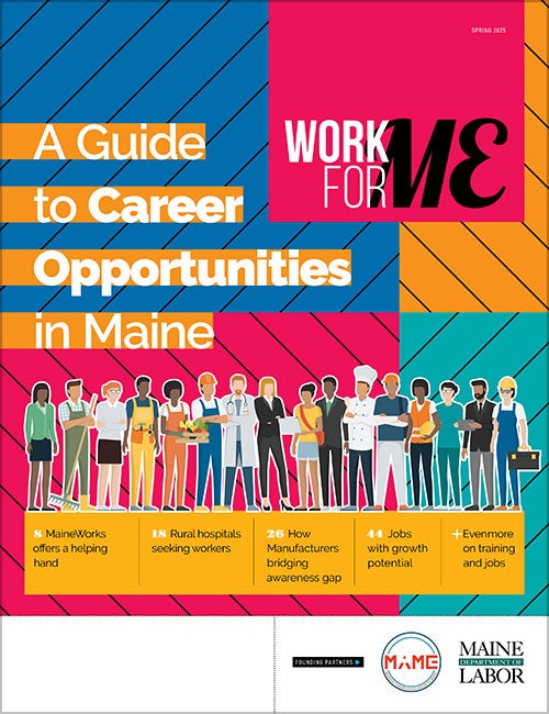
Work for ME
Work for ME is a workforce development tool to help Maine’s employers target Maine’s emerging workforce. Work for ME highlights each industry, its impact on Maine’s economy, the jobs available to entry-level workers, the training and education needed to get a career started.
Learn More
Groundbreaking Maine
Whether you’re a developer, financer, architect, or industry enthusiast, Groundbreaking Maine is crafted to be your go-to source for valuable insights in Maine’s real estate and construction community.
Learn more-
The Giving Guide
The Giving Guide helps nonprofits have the opportunity to showcase and differentiate their organizations so that businesses better understand how they can contribute to a nonprofit’s mission and work.
-
Work for ME
Work for ME is a workforce development tool to help Maine’s employers target Maine’s emerging workforce. Work for ME highlights each industry, its impact on Maine’s economy, the jobs available to entry-level workers, the training and education needed to get a career started.
-
Groundbreaking Maine
Whether you’re a developer, financer, architect, or industry enthusiast, Groundbreaking Maine is crafted to be your go-to source for valuable insights in Maine’s real estate and construction community.
ABOUT
NEW ENGLAND BUSINESS MEDIA SITES
No articles left
Get access now
In order to use this feature, we need some information from you. You can also login or register for a free account.
By clicking submit you are agreeing to our cookie usage and Privacy Policy
Already have an account? Login
Already have an account? Login
Want to create an account? Register


Comments