New tool will help working waterfronts track threats, changes
 Courtesy / Maine Coast Fishermen’s Association
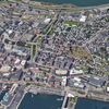
Port Clyde, a village in the peninsula town of St. George in the midcoast, has long been a vital commercial fishing port.
A new digital tool aims to help municipalities inventory their working waterfronts by tracking changes, threats and opportunities.
Maine Coast Fishermen’s Association in Brunswick and Tidal Bay Consulting in South Freeport produced a working waterfront inventory template as a toolkit to understand public and private infrastructure and local marine economy.
Compiling baseline information is expected to help towns monitor change over time and fund projects that can preserve vital infrastructure while considering development and vulnerability to sea level rise. The tool is designed for committee volunteers or town staff such as a harbormaster or planner.
“Understanding what we have on the waterfront in a town like Harpswell is incredibly important,” Harpswell Harbormaster Paul Plummer said in a news release.
The template, he said, will help towns work with the fishing industry “to identify ways to protect and preserve the waterfront, identify potential future access points, and access state or federal funding that can support necessary projects to ensure a thriving waterfront in the future.”
According to a 2021 Island Institute report, “The Critical Nature of Maine’s Working Waterfront and Access to the Shore,” Maine’s working waterfront is waning. Of 5,000 miles of Maine coastline, just 20 miles is available as working waterfront. Development pressures and rising shorefront property taxes are making it harder to retain that small portion. Yet all of Maine’s seafood crosses a working waterfront.
To date, little information is regularly collected by municipalities to track changes, threats and opportunities in and around the working waterfront. Much of the infrastructure is managed at a municipal level and has been impacted by coastal gentrification and an influx of new residents, resulting in increased development and the transition of property ownership, as well as creating new demands on municipal services.
Many coastal communities have started exploring ways to document and protect the working waterfront. But few tools have been available to date to assist the effort.
The template is designed to help communities identify the needs of the working waterfront and access resources to help them incorporate the working waterfront into their comprehensive plans, zoning and harbor ordinances, capital improvement plans, grant proposals, or climate resiliency planning process.
“Without historical working waterfront infrastructure or the potential for new infrastructure, what is a very difficult job physically and financially, becomes increasingly difficult, if not impossible,” said Hugh Bowen, a lobsterman from Freeport.
An associated report includes information about why a municipality should complete an inventory, a checklist of how to prepare before starting the inventory, and instructions on how to fill out the inventory tables.
To read the report, click here.


0 Comments